Anaheim Planning Commission meeting for November 6, 2023

The Anaheim Planning Commission has a scheduled meeting on November 6, 2023 at 5:00pm in the city council chambers. The agenda for the meeting is available online.

There are three items on the agenda for this meeting, the most we’ve had in months. The items are very similar to many of the other recent items we’ve had over the past few months.

Item 1 - CUP - Escape Room

The first item on the agenda is a Conditional Use Permit (CUP) for an escape room located on Center Street Promenade. This building is zoned for general commercial with a General Plan land use of Mixed-Use Urban Core. I’m really unsure why a CUP is needed for this at all. I’m actually unsure what the “use” is that would be identified in the zoning code, since it doesn’t specify escape rooms at all. My best guess is an entertainment use, but this seems like such a broad category that for an escape room to be drawn into it is a disservice to the business owner that just wants to get their business up and running.

Item 2 - CUP - Drive Thru Starbucks

Just like at the August 28th meeting, we have a proposal for another drive thru Starbucks. This one will be on East Street, north of La Palma, in the parking lot of the Northgate Gonzalez Market. An existing retail building would be demolished and replaced by a substantially smaller building for the Starbucks. This would be one of those Starbucks that doesn’t have any interior area for customers, but would primarily be a drive thru with a window for walkup orders.

As I said at the last planning commission meeting, we shouldn’t be allowing drive thrus at all, because they simply reinvest in the car dependence of our community. However, drive thrus are a conditionally allowed use, and this owner has followed all of the City’s rules to have their request considered.

As part of this proposal’s environmental analysis, the applicant had a Vehicle Miles Traveled (VMT) Screening Assessment completed to determine if the project increasing VMTs, and therefore greenhouse gas emissions from cars. This assessment didn’t end up calculating the VMT generation from this use because it’s 1) within a transit priority area; and 2) less than 50,000 square feet. It seems absolutely ridiculous that a drive thru of any sort can escape this analysis because it’s close to transit and is presumed to be “local serving”. This simply isn’t a store that many people will be walking to or using on their way to and from the local transit line. This use simply contributes to the reliance on cars to get around Anaheim.

Item 3 - CUP - Oversized Vehicle Storage

It’s interesting that this is our third request for an oversized vehicle storage yard over the past few months, and I can’t ever remember having one of these requests in the past. This one is right at the northern boundary of the city, near Orangethorpe, east of Tustin Ave. This is a huge site for this type of use, 7.75 acres, and is adjacent to a bunch of other vehicle storage yards. Overall, it seems very similar, just larger, to the other oversized vehicle storage yards the Planning Commission has recently approved.

Anaheim Planning Commission meeting for October 23, 2023

The Anaheim Planning Commission has a scheduled meeting on October 23, 2023 at 5:00pm in the city council chambers. The agenda for the meeting is available online here.

There are two meetings on this agenda, the most interesting thing about these two items is that they’re for the same shopping center.

Item 1 - CUP & Variance for Drive Thru and Car Wash

The owner of the Walmart shopping center at the corner of Orangethorpe and Lemon are proposing a new drive through restaurant and car wash. In addition, they want to install some pole mounted signs in the future right of way along Lemon Street.

I see two challenges with this proposal. First, these businesses simply make our neighborhoods worse. They further invest in a car-oriented pattern of development that makes our city poorer, and our residents less healthy and more unhappy. However, as a city, we don’t have a plan to do anything else other than car oriented development.

The second challenge is that the new buildings are proposed to be near the ultimate right of way, and once the road is widened, there won’t be a landscape setback between the building and the sidewalk.

Item 2 - CUP for Drive Thru & Parking Reduction

Within the same center as the proposed drive through and car wash is another proposed drive through on a separate parcel, apparently owned by different owners. This property owner is proposing another drive through and a reduction in required parking.

The interesting thing about this proposal is that the city cannot use a Class 3 categorical exemption from CEQA due to a past cleanup order on the site that was closed in the 1980s. Therefore, the city is proposing a common sense exemption for this project instead of doing CEQA review. I’m interested in digging into this at the public hearing for this item.

Grant Henninger
Anaheim Planning Commission meeting for October 9, 2023

The Anaheim Planning Commission has a scheduled meeting on October 9, 2023 at 5:00pm in the city council chambers. The agenda for the meeting is available online here.

This is the Commission’s first meeting in more than a month, and it only has one action item and one workshop. The workshop will be the most interesting part of the meeting.

Item 1 - CUP & Variance - Outdoor Storage Yard - 1051 N. Patt St.

The only action item on today’s agenda is a request for a Conditional Use Permit and Variance for an outdoor trailer storage yard at 1051 N. Patt St. This is a very similar request, although a bit simpler, as one that the Planning Commission heard at the end of July (which I didn’t write about at the time.)

This request is to allow a trailer storage yard that would accommodate 24 trailers on an industrial zoned property. The City’s zoning code requires a Conditional Use Permit for any outdoor storage use in the industrial zone. In addition, the code requires that this type of outdoor storage use is only permitted on lots larger than 1.5 acres. However, this parcel is 1.45 acres, so they’re requesting a variance for the project.

The surrounding uses for this project are mostly industrial, with multiple nearby parcels being used for outdoor storage. In addition, the code requires the parcel to be 1.5 acres, and 1.45 acres rounds up to 1.5 acres if staff didn’t add an additional significant figure to the measurement.

I’ll be interested to see if my commission colleagues or members of the public have any concerns about this application.

Workshop - Disneyland Forward

Much more interesting tonight will be the workshop presentation regarding Disneyland Forward’s environmental review. The Draft Subsequent Environmental Impact Report is available for public review and comment now through October 30th. Tonight’s workshop is to provide an overview of the EIR and the project as a whole. There will be no action taken by the Planning Commission on this project tonight, this is just the first step in providing the Commission information regarding the project so we’re more informed when it comes before us in the future. This is a huge project for Anaheim, and I’m excited to start digging into what Disney is proposing for their property.

Anaheim Planning Commission meeting for August 28, 2023

The Anaheim Planning Commission has a scheduled meeting on August 28, 2023 at 5:00pm in the city council chambers. The agenda for the meeting is available online.

Unfortunately, I had missed writing about the past couple of meetings, which were the most interesting meetings we’ve had since I came back to Planning Commission. July and the beginning of August had just been too busy with work and travel.

There is just one item on this week’s agenda, and the only interesting thing about it is that it’s the same property we looked at back in January.

Item 1 - CUP - 1010 - 1098 North Euclid Avenue

The only item on this week’s agenda is a request for a Conditional Use Permit for the construction of two drive through restaurants within an existing shopping center. The staff report for this item can be found online.

Back in January, the Planning Commission approved a liquor licenses for a new grocery store in this center. This request would add two new drive through restaurants to the center, in addition to the other improvements associated with the new grocery store. The two new restaurants would include a Starbucks and a Gallo Giro.

This property is zoned for general commercial uses, where drive through restaurants are conditionally allowed subject to the approval of a conditional use permit. To approve a CUP, the planning commission must find that the proposal is consistent with what may be allowed, that it doesn’t adversely affect the surrounding properties, that the size and shape of the site is adequate to accommodate the proposed uses, that the proposed uses won’t create an undue burden on the traffic on surrounding streets.

Personally, I don’t think the City’s zoning code should allow for drive through restaurants anywhere. They contribute to the car-centric nature of Anaheim. We should be working towards moving people without the need for a car, and providing more options for residents to get around. Building new drive throughs will make it that much more difficult, and take that much longer, before we can have truly livable neighborhoods. Unfortunately, there is no plan to transform Anaheim into a livable city, so we’re stuck with deciding these proposed drive throughs on the zoning code we have, not the one I wish we had.

Challenges with Corridor Zoning

Corridor based development has gained significant popularity in recent years. Last year, California passed AB 2011 and AB 2097, which removed parking requirements statewide for new developments along high-quality transportation corridors and required by-right development for residential developments that include affordable housing. These efforts have been championed by Peter Calthorpe for years, and are now gaining traction. In fact, this year’s theme for CNU was The Corridor and the City.

These efforts aren’t just limited to envisioning what could be, cities are also implementing corridor-based upzoning. Anaheim adopted the Beach Blvd Specific Plan, Berkeley has the Adeline Corridor Specific Plan, and Artesia has the Artesia Boulevard Corridor Specific Plan, to name just a few.

However, these types of efforts that are limited to the parcels that front an arterial roadway will have limited success when it comes to creating a vibrant, walkable community.

Cars, Traffic & Parking

First and foremost, these types of corridors are commonly the worst type of stroad. They are high volume, high speed roadways that also have a lot of complexity, with significant numbers of driveways, pedestrians, and other complications that make for unsafe conditions at high speeds.

Simply building higher density, more intense land uses on the stroad’s edge does not make it instantly walkable and able to support a prosperous place. Instead, any corridor plan needs to address how the existing traffic volume through the corridor will be reduced and slowed. In some cases, this can be accomplished through the addition of transit systems that get people out of their cars, but only if a significant portion of the traffic has both their origination and destination along the corridor that’s served by the transit line.

The best way to address the traffic is by redesigning the roadway to lower traffic speeds and volume. This can be done by eliminating travel lanes and reducing lane widths. However, this will result in increased traffic, and will cause some drivers to divert to other routes, away from the walkable corridor. This outcome should be disclosed to all stakeholders during the planning process so there are no surprises when the corridor plan is implemented.

This increase in traffic, and the perception that existing parking will be further impacted by the increased density, creates the biggest source of opposition for this type of corridor transformation. In order to reduce people’s fears of the impending parking apocalypse caused by higher density uses, any corridor plan needs to provide a believable strategy for reducing, diverting, and eliminating car travel along the corridor.

Expanding Beyond the Corridor

The second problem with corridor-based upzoning is that despite the increased densities, often there are not enough households to support all of life’s necessities within walking distance of every home along the corridor. As explained better in The Affordable City, this means that despite the desire for these areas to embody the 15-minute city concept, in reality people will still need to get in their cars to fulfill their daily tasks.

As a result, there will be greater demand for parking and there will be more traffic, just as people fear. This, in turn, results in corridors that are nothing more than high-density, auto-oriented suburbs. A great example of this type of development is the Platinum Triangle in Anaheim, where everyone needs a car despite there being sufficient density to allow for a walkable community.

This is exactly the type of development along the Lynx Blue Line in Charlotte. The parcels adjacent to the Blue Line were high density mixed use developments, but just a block away were vacant lots and abandoned buildings. The businesses in these new buildings need a lot more homes around them to survive on foot traffic alone, and the residents of these buildings still don’t have all of their daily needs taken care of within a walkable distance. The result is buildings with nine levels of parking and streets that need to accommodate all of those cars.

To fix this, cities need to expand beyond the corridor. Walkable communities need to be two dimensional, expanding not only along the axis of the corridor, but perpendicular along the side streets and adjacent parallel roads. By expanding the allowable higher densities uses, even just a block or two in either direction from the main corridor, cities can greatly expand the number of people within walking distance of everything within the corridor.

As cities move towards walkable urbanism, shifting the existing built environment to something new will be a real challenge. While it’s good that cities are embracing corridor-based zoning, they need to look at the foreseeable problems these plans will create and work to implement solutions before the plans are implemented. The biggest problem will continue to be parking and traffic until there is enough dense development, across a wide enough area, to transition the primary means of transportation away from the car.

Grant Henninger
Book Review: The Affordable City

The Affordable City completely changed the way I think about affordable housing advocacy. I’ve been working in the industry ever since my first job out of college at a non-profit affordable housing developer, so to say that this book completely changed my perspective is a real testament to Shane Phillips and the way he breaks down issues around housing affordability.

The three key policies that Shane structures the book around are the three S’s: Supply, Stability, and Subsidy.

The first and third of these S’s, Supply and Subsidy, I’ve understood well. I’ve always come to housing affordability through what has come to be the YIMBY view, that we need to build more housing so that housing supply will meet housing demand. It’s a simple, economics 101 view of the housing market. As someone who has developed affordable housing, I’m also keenly aware of the need for subsidy to build homes for the lowest income families in our communities.

What this book really opened my eyes to was the need for housing price stability. I have often viewed tenants rights advocates as a hindrance to long term housing affordability. Too often, tenant advocates fight against new housing, which in turn makes housing less affordable over the long term. Because of this, I’ve viewed tenants rights in opposition to long-term housing affordability, or at best the choice between housing affordability for current residents and housing affordability for future generations.

In its introduction, The Affordable City makes a convincing case that future housing affordability cannot be achieved at the expense of displacement of existing residents. For a city to be affordable, it must protect existing residents while making room for future growth.

From this starting point, Shane Phillips builds a case for specific policies that, over time, will build an affordable city. The policies are broken down into each of the three S’s. The policies that are most clearly laid out relate to building the housing supply. It is clear that Shane comes from a background similar to my own, and that housing supply is what he has thought about the most when it comes to housing affordability. As the book starts to talk about tenant protections, the lines of thought seem less clear and the passages are filled with more jargon. However, even these nascent policy ideas helped me round out my own thinking about housing affordability.

Most importantly, The Affordable City makes the case that tenants rights advocates and housing supply advocates need to come together and support one another to ensure there is enough political will supporting housing affordability policies. Cities need tenant protections and new housing to ensure that current residents aren’t displaced and that housing costs grow slower than inflation.

The different housing advocacy groups need to be working together to craft policies that work to achieve all of the housing goals simultaneously. In some cases, this might mean not upzoning parcels that already have naturally occurring affordable housing or supporting some rent control. But it also means that any rent control initiative needs to be structured in a way to ensure that it doesn’t create a constraint on future housing development.

The task for any community organizer working toward a more affordable city is to build the bridges between YIMBYs and those most at risk of displacement. Here in California, a lot of work is being done at the state level to marry the policy goals of the two groups (see the YIMBY support for SB 466, which would allow for rent control on newer buildings than allowed currently.) However, at the local level we haven’t yet seen the same coming together of the different advocacy groups. But without joint advocacy, neither group has enough political might to push through any policies that help create a more affordable city.

The Affordable City is required reading for anyone working for housing affordability. It provides the blueprint we need to bring together all of the different groups working in this space. I gave away my first copy of the book to the head of a local tenant union, and I plan to buy more copies to help spread the good word. It’s just that vital of a book if we hope to make our cities more affordable for everyone.

Anaheim Planning Commission meeting for June 5, 2023

The Anaheim Planning Commission has a scheduled meeting on June 5, 2023 at 5:00pm in the city council chambers. The agenda for the meeting is available online.

Once again, there is only one item on the agenda, a CUP amendment for the expansion of a bar.

Item 1 - CUP Amendment - The Cave Sports Bar

The Cave Sports Bar is located on Orangewood Avenue, west of Harbor Blvd. It’s located in a small strip retail center at the end of a residential block. The request is to amend the bar’s existing CUP to allow it to expand into the neighboring vacant retail space. This center is mostly vacant, other than this bar that was originally approved in 1978, and a Mexican restaurant. The property is designated in the General Plan for Medium Density Residential development, although the zoning is General Commercial.

This mismatch between the General Plan and Zoning designations concerns me. On the one hand, zoning says this is a permitted use. On the other hand, the long-term vision for this property is for residential uses. I do wonder how many parcels throughout the city have land use and zoning designations that don’t match. It seems like these two planning documents should be consistent with one another. It would be a simple matter to change the zoning to match the designated land use and allow the existing uses to remain as existing non-conforming. Doing so would probably not even affect this request.

With all of that said, in a housing crisis, it seems like it would be better public policy for this property to convert to residential uses sooner rather than later. However, allowing this bar to expand will result is less pressure on the property owner to do something else with the property. The minor investment in the property by the bar will need to be amortized over several years, and the property owner will be generating more rent so will be less likely to sell or redevelop. The question becomes whether we should allow this investment, locking in the current use for the foreseeable future, or disallow this request to encourage the future land use to develop.

On another note, just something that is interesting, is that this is the first development that I’ve seen that has been exempt from parking requirements due to AB 2097. Not that it would matter for this request, since the site has plenty of parking for the existing tenants, but if the site ever does redevelop it’ll be interesting to see what sort of parking is provided on the site.

Strong Towns National Gathering

As I wrote about in my review of Confessions of a Recovering Engineer, I’ve been involved with Strong Towns and have been friends with Chuck for many years. This year, Strong Towns held a National Gathering in Charlotte, NC in conjunction with the Congress for the New Urbanism. It was an inspiring gathering.

What this National Gathering showed, more than anything, was how transformed Strong Towns has become over the past decade as both an organization and a movement. A decade ago, Strong Towns was run off of the charisma of Chuck. When Strong Towns put on a smaller group, Chuck was the center of attention. I expected that Chuck would be absolutely mobbed at the National Gathering, but that wasn’t the case at all.

There were five hundred people from all over the country that attended the National Gathering, and they were largely here for the ideas and the broader community of like-minded people. It did not feel like we were all here to see just one person, or that one person was even the center of attention. Over the past five years, Strong Towns has raised the voices of many people and really expanded beyond Chuck. The movement has moved beyond just Chuck, and in many ways the community doesn’t need him anymore, he has just become another member of the community.

And community was really the common thread throughout much of the Gathering. I came to Strong Towns a decade ago largely because of the focus on community, especially Gracen Johnson’s early contributions to the Strong Towns blog. One of the popular sessions during the Gathering was about creating an ecosystem of townmakers in our local communities. This session really focused on creating small groups of small developers all working in the same community who can help support one another as they learn how to be developers.

On a completely different track, there was a great session by M. Nolan Gray that distilled Arbitrary Lines down to a 45 minute talk. While he had many great points, listening to his talk as a planning commissioner, what resonated with me the most was a statement that cities micromanage private property to mitigate impacts between neighbors, but they let the public realm go to shit. Looking around Southern California, this was something that was immediately apparent once it’s pointed out, and drove home the point that zoning reform is necessary, but not sufficient by itself.

Coming out of that session, Rick Cole was able to introduce me to Nolan, and we had a very interesting and productive conversation about housing production in California. This is the most powerful type of outcome of the Gathering, connecting people who can inspire and collaborate. This is the fundamental action of community building, connecting people so they’re better off from the connection than they would be without it. This is why Strong Towns has grown and become a community focused organization instead of just being focused on Chuck. I joined Strong Towns because I was seeking community, and the National Gathering was a great opportunity to bring community together. I look forward to them hosting it again next year.

Grant Henninger
Unintended Consequences

I’ve spent a lot of time driving on the Arroyo Seco Parkway lately. As I’ve driven up and down this narrow and winding freeway, I’ve been struck by the feeling of optimism that resonates through that very first freeway. It’s interesting looking back comparing what the freeway builders must’ve thought the future would be like, and comparing it to the hellscape that we’ve created by our reliance on cars. It really got me thinking about the unintended consequences of the planning decisions that we make today. 

It’s hard to drive through this part of LA with these thoughts and not also think about the unintended consequences of our housing policy over the past 70 years. As a reaction to slowly increasing density in the suburbs around Los Angeles, we saw cities react by not allowing additional density at all. Of course, this created the housing crisis they were in today, which I am sure was an unintended consequence of those past actions. Now, instead of having slow, incremental development over these past decades, cities are faced with rapid change to ensure that all residents have the Housing they need.

Looking at the decisions we are making today, I wonder what the unintended consequences will be of those policies and plans. Are we making the same mistakes of the past by not considering what the consequences of our actions will be? 

It’s interesting being in the planning profession, our jobs are to plan for and focus on the future of cities, but so often we fail to understand the unintended consequences of the policies we champion. This is true of all sorts of advocates (and planners must be advocates at some level, even if it’s just recommending a project someone else proposed.) 

Looking at other industries, it’s obvious that the technology innovations of today have the potential to create a better future, but can also be corrupted and make the world a worse place. Electric vehicles will help the world reduce our greenhouse gas emissions, but could further entrenched our reliance on the automobile. AI, such as ChatGPT and Midjourney, may make society much more productive but also has the potential to destroy entire industries. Not working in these industries allows me to see the potential pitfalls of these new technologies. However, I don’t feel like I have that same perspective when it comes to planning policies.

Planners are often passionate about building the best cities possible. Often, when new ideas and fads are presented that have the promise of creating better cities, planners will embrace them with open arms. This embrace can then blind planners to the pitfalls and unintended consequences of these new ideas. However, people not in the planning profession can have a more clear view of those potential pitfalls. As planners, we must listen to those concerns, separate the real concerns from the fear of change, and take them into account when making our plans. 

Driving down the Arroyo Seco Parkway serves as a good reminder that we must look outside ourselves to check for biases and temper our excitement with a dose of reality at times to ensure that the policies that we champion, that we hope will bring about a better world, don’t have unintended consequences that we don’t see.

Grant Henninger
Book Review: Arbitrary Lines

Arbitrary Lines is the best recent primer on zoning in America. However, it is not without its faults.

In Arbitrary Lines, author M. Nolan Gray provides a history of zoning, its purpose, and the problems it causes. He goes on to advocate for fixes to zoning to solve those problems, and the eventual elimination of zoning altogether. This might sound dry and boring, but as is discussed in Arbitrary Lines, zoning has become an increasingly popular topic and the book is artfully written to remain engaging throughout.

The book starts with a history of the American city and the changes brought about by industrial revolution technologies. The technology people often think of is the car, but the steel frame building and the elevator, as well as the streetcar are equally important in the way our cities have changed. It is these technological changes that we’re still grappling with today, and just another example in the long history of how society, and especially our cities, change with new technology.

The book continues with a history of how cities responded to these changes, culminating with zoning, which only dates back about a hundred years. Once the original history and purpose of zoning is established the bulk of the book discusses the problems created by zoning. Here is one of the areas Arbitrary Lines falls short. In describing the problems brought about by zoning, it ignores the many other causes of the identified problems. That is not to say that zoning isn’t a factor in any of the identified problems, but it is by no means the only or even primary factor for many of them. There simply seems to be an overfitting of changes in American society over the past 40 years to changes in zoning starting in the 1970s as their cause. This is especially true in Chapter 4, regarding the wealth we’ve lost. 

M. Nolan Gray spends a lot of time in the book discussing high housing costs, and people not moving to productive cities because of those costs. Here, again, the book falls a bit short. The language used confuses the issue, and conflates high costs and lack of supply of housing. People are not moving to more productive places because high housing costs will eat up any wage growth they may have, as the book argues. Instead, people are not moving to more productive places because there are not enough homes in these places. While these two issues are related, they are distinctly different. If all of the people who wanted to live in more productive places move to them, many of those people would be homeless no matter how much they were willing to spend for their housing simply because there’s not enough housing to go around.

Overall, these are minor quibbles in the scheme of the book. These issues do not change the underpinnings of the argument for reforming zoning. While the identification of the issues caused by zoning may be correct, the solution to these issues feel like a leap. In many ways, this feels like the same problem Karl Marx had in Capital, where the identification of the problems with the capitalist system were right on, but his prescription for fixing those problems were off base. 

Towards the end of Arbitrary Lines, after talking about possible reforms to zoning, M. Nolan Gray uses the lack of local zoning in Japan and Houston to make the case that zoning should be abolished everywhere. While this was an interesting discussion, it both seems like too few examples to use when discussing discarding the cornerstone of American planning, and too far of a leap for cities to undertake in a single bound. 

Instead of the more than 50 pages given over to exploring abolishing zoning, expanding the appendix to be the final third of the book would have been a much better use of paper and ink. The appendix covers many of the societal changes that have compounded the issues surrounding zoning but weren’t mentioned in the body of the book. In fact, the appendix provides a good basis for a deeper and more holistic understanding of how our cities are developed. As the author says in the appendix, zoning cannot build anything, it can only stop things from being built. Instead of focusing on abolishing zoning, it would have been interesting to look at all of the ways our cities get built, from comprehensive plans that set a vision for a city, to how developments get financed to determine what gets built. 

Arbitrary Lines is a great book for people that want to understand zoning in America. The overview of the history of zoning, the changes to our cities due to industrialization, and the problems that zoning creates are must reads for anyone interested in making our cities work better. It will likely be the first book I share with my Planning Commission colleagues in the near future.

Grant Henninger
Choices & Tradeoffs

Urban planning is a series of choices and tradeoffs. Understanding these tradeoffs is critical when planning for a city’s future. Too often, residents advocate for, and city decision makers pursue, a course of action without fully understanding all of the foreseeable ramifications of that course of action. Planners must make a concerted effort to communicate all of the impacts, and help decision makers understand the tradeoffs inherent in their decisions.

The most common and relatable example of residents advocating for a course of action with foreseeable but unexamined consequences is traffic reduction. In community meetings and city halls across the country, residents raise concerns about traffic and want to see increased roadway capacity to reduce traffic congestion. 

There are two ways to increase roadway capacity, either increase the number of lanes or increase the speed of the existing lanes. Both of these strategies create foreseeable negative impacts, including streets that are less walkable, less neighborly, less safe, more damaging to the environment, and harmful to neighborhood businesses. However, these secondary impacts of increasing roadway capacity are rarely considered until they start to be felt in the community, and by then it’s often too late to reverse the impact.

When policies and projects are considered at city hall, the direct impacts are often examined. Most city council staff reports will have a section related to the impact on the city’s budget (but they only examine direct costs), and there will often be an environmental study that analyzes how a project or policy will directly impact the environment. However, the analysis stops at those direct sorts of impacts. 

Policies and projects should be analyzed not just on these direct impacts, but on the knowable secondary impacts as well. This is not to say that all secondary impacts are knowable, but many are and should be looked at when they’re known. This analysis of secondary impacts should tie back to the city’s goals and vision for how it wants to develop. 

While each and every policy and project should support the city’s overarching vision, sometimes projects will support one goal while harming another. Too often, the goal the project supports will be mentioned, but the goal the project harms will remain absent. It is these types of tradeoffs that need to be raised and considered. It might be that the goal the project supports is more important, or that the benefit to one goal outweighs the harm to the other goal.

Decision makers cannot make well informed decisions if they don’t fully understand the choices they’re making, and the tradeoffs they entail. It is incumbent on planners to help decision makers fully understand the tradeoffs inherent in the decisions they make. This is the only way to create cities that are livable with intention. 

Grant Henninger
Anaheim Planning Commission meeting for May 22, 2023

The Anaheim Planning Commission has a scheduled meeting on May 22, 2023 at 5:00pm in the city council chambers. The agenda for the meeting is available online.

There is only one item on the agenda, and it’s very similar to Item 1 from the last meeting. It seems like a very straightforward request, but I’m going to complicate it a bit.

Item 1 - Variance Request - Southern California Institute of Technology

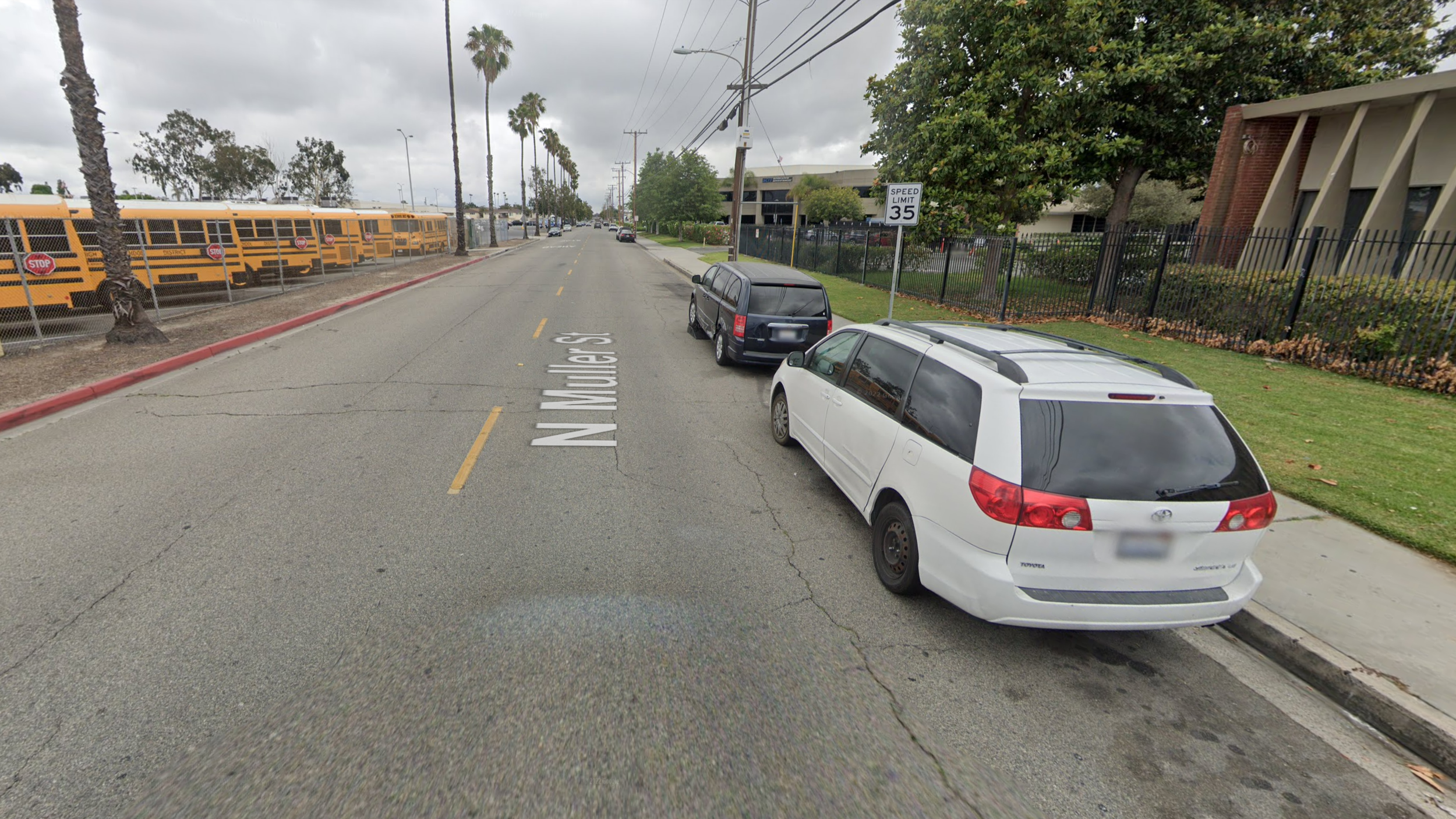
Muller St. looking north at Corporate Way

The Southern California Institute of Technology is requesting a variance to allow for a six-foot tall fence around their property within the required landscape setback. The site is located on the northwest corner of N. Muller St. and W. Corporate Way. The proposed fence would be along the frontages on both streets. The required setback along Muller is 15 feet, with the proposed fence located seven and a half feet from the property line. The required setback along Corporate Way is five feet, which the where the fence would be located except where the Corporate Way cul-de-sac bulb encroaches into the property.

When this project was originally approved back in the 1990s, the code only required a 10 foot setback along Muller St. Because of this, the parking lot is built right up to the old setback line, and there isn’t the ability to build a fence at the new setback line without removing parking. The applicant wants to install the fence to reduce the amount of trespassing and vandalism on their site, and to cut down on the number of cars illegally parking in their lot.

One of the findings that the Commission needs to make is that, “because of special circumstances, strict application of the zoning code deprives the property of privileges enjoyed by other property under identical zoning classification.” The staff report cites two adjacent properties that have been allowed to construct fences within the required right of way.

Across the street to the east is an Anaheim Union High School District offices and bus depot. The site is enclosed with a chain link fence that’s located less than ten feet from the curb. Judging by the architecture of the buildings there, I’d estimate that this site was developed in the 1960s or ‘70s, long before the current setback requirements were in place. My expectation is that if this site was to be developed today with the exact same uses, it would be required to provide a 15-foot landscape buffer from the street right of way. When we update the code, we should not be required to allow future applicants to reduce their requirements to the old standard just because neighboring properties were developed under the old standard. The school district property is poor justification for approving this proposal.

Muller St. looking south from Crescent Way

Muller St. looking south from Crescent Way

The property just north of the Southern California Institute of Technology provides better justification, but is also a cautionary tale. This church property was allowed to build a similar fence within the required setback. (Although I don’t know when this fence was built, or what the required setback was when it was built, so it may be that it didn’t need a variance. This is something I’m going to need to ask about.) However, looking at this streetscape, I’m unsure if this condition is something we want to perpetuate and expand. A narrow road with fences on both sides feels a lot like a prison corridor.

The problem with this street is, as Jane Jacobs would say, there are not enough eyes on the street. When buildings turn their back on the street, or are shut away by walls and fences, it increases the likelihood of unwanted behavior on the street. This block appears to have long been out of sight. There are two options for a street like this, either wall off everyone’s property and make the street into a true car sewer, or open up properties to the street and put more eyes on it. I don’t see such a change in direction happening for this street, so it might be that continuing to wall it off is the best option for this particular property owner, but it’s just going to make the task of bringing life back to the street more difficult in the future.

Book Review: Confessions of a Recovering Engineer

I’m writing this review while wearing my brand new Strong Towns t-shirt. I only bring this up to acknowledge my own bias when coming to this latest text by my friend Chuck Marohn. 

Chuck started the Strong Towns blog a decade and a half ago and has grown it into one of the most influential movements in the urban planning field. Confessions of a Recovering Engineer, published in 2021, is the latest outgrowth of this advocacy. 

Confessions is a bit of a followup to Chuck’s 2019 Strong Towns: A Bottom-Up Revolution to Rebuild American Prosperity. In Strong Towns, Chuck lays out the entire Strong Towns approach to city building. It’s summed up in the idea that cities should observe residents’ needs and do what’s in their power immediately to meet those needs, then repeat. There is a lot more details in the 200+ page text and hundreds of blog posts that Chuck has written, but that’s the foundation of all of it.

While Strong Towns focuses on city building as a whole, Confessions focuses entirely on a city’s transportation network. Confessions starts with a powerful personal story about traffic violence that was caused by roadway design. From there, it builds the case that road design impacts driving behavior and how the engineering profession contributes to unsafe roads and unproductive places.

Along the way, Chuck provides a great primer on how a city’s transportation network can support or hinder the City’s ability to be a productive place. Unfortunately, there is not enough detail on this topic for residents to knowledgeably advocate for a better street network. Chuck does not talk about the different choices cities can make for their transportation network, and the tradeoffs between those different choices. While Confessions isn’t intended as a one-stop shop for transportation advocacy, it could provide additional information or pointers to resources beyond confessions.engineer for people to learn more about how cities can build better transit options. With Strong Towns coming out in early 2019, and Confessions coming out in late 2021, maybe Chuck is working on a more detailed followup exploring these issues to be released in late 2023 or early 2024.

While Chuck leaves out some of the explanations on how the transportation network interacts with other areas of city building, he includes some ideas that don’t seem to fit with the book as a whole. There is an entire chapter dedicated to the routine traffic stop. While this is certainly related to the transportation network and is a key issue for many communities, the way it was addressed in the book felt like a tangent or afterthought. Additionally, there is an entire chapter on transportation fads that already feels out of date less than two years after publication. While these sections were interesting, and some of them important topics, they didn’t help support the overall theme of the book.

The other area where Confessions fell short was in understanding how a city’s transportation network creates the basis for which all land uses are built upon. The book is very focused on transportation, but doesn’t make the connections between transportation and land use and livability within cities. Chapter 2, The Difference Between a Road and a Street, talks extensively about how lower speed streets support a productive place, and higher speed roads are best to connect productive places. However, there isn’t much discussion about the other aspects of building productive places. 

This distinction between streets and roads is a key concept throughout all of Strong Towns. Streets provide for low speed travel through communities, while roads provide high speed connections between them. This distinction makes a lot of sense throughout much of North America where cities are distinct places separated by rural areas. It is much more difficult to apply this distinction within San Angeles (the mega city that spans from Ventura to San Diego). Throughout urban Southern California, there are no real community centers of productive activity that can serve as distinct nodes to connect with high speed roadways. Instead, there is a more or less uniform density and productive capacity throughout much of the southland. This makes it very difficult to apply the lessons identified in Confessions to city building in Southern California. 

Overall, Confessions of a Recovering Engineer provides a great overview for understanding how our existing road designs are failing our communities and what cities could do to improve them. I was hoping that this would be a great first book for new city council members and planning commissioners to introduce them to the ideas related to building better cities. Unfortunately, Confessions is both too focused on transportation and not specific enough in application to be a good resource for city decision makers. But that wasn’t Chuck’s target audience for this book. His target audience was the general public who want to advocate for improvements in their own communities. For that audience, this book is almost perfect.

Anaheim Planning Commission meeting for May 8, 2023

The Anaheim Planning Commission has a scheduled meeting on May 8, 2023 at 5:00pm in the city council chambers. The agenda for the meeting is available online.

There are two, very minor items on this agenda.

Item 1 - Variance Request - Walnut Village

The Walnut Village retirement community was approved by the City in 2004. The approval included a fence with pilasters around part of the property, including along the entire perimeter along Walnut Street and part of the perimeter along Ball Road. This request would extend the fence along the remainder of the perimeter of the property along Ball Road.

The variance is needed because the fence and its pilasters would be located within the property’s landscape setback along Ball Road and be taller than allowed by code.

The property has had numerous instances of trespassing, burglary, and vandalism in recent years. This additional fence is intended to ensure the community is more secure from these types of property crimes.

Item 2 - CUP & ABC License - TJ Liquor

This request is for a Conditional Use Permit and determination of public convenience or necessity to permit sale of alcohol at TJ Liquor on Lincoln Avenue at Dale St. TJ Liquor is an existing liquor store that is moving locations to a larger space within the same shopping center. This request amounts to a change of address, for the business and nothing more.

Anaheim Planning Commission meeting for April 24, 2023

The Anaheim Planning Commission has a scheduled meeting on April 24, 2023 at 5:00pm in the city council chambers. The agenda for the meeting is available online.

This is one of our more full agendas recently, with three items.

Item 1 - Variance Request - Four-unit Apartment Building

This request for several variances relate to the development of a four-unit apartment building located at 308 W. Vermont Ave. The specific requests are to reduce the setback between the buildings and an interior lot line from 20 feet down to four feet, reduce the landscape setback from an interior property line from five feet down to four feet, and reduction in common area recreation-leisure area from 80 square feet to 0 square feet.

The building will be built to RM-4 standards, which typically require 70 lot widths. This lot is only 54 feet wide, but since it already exists it can still be built to these standards without any variance for the lot width. However, since the lot is narrower than is typical for RM-4 standards, it’s difficult to fit a building on the site with the typical setbacks, which is why this variance is being requested.

My concern with reducing the setbacks from 20 feet down to four feet is whether there is sufficient space between the building and property line to access and maintain that area, and for any landscaping to grow in such a small area. Looking at the satellite and street view images of the property, it appears that there are block walls along both property lines. It would be difficult to get access between the building and the wall, and I worry that garbage will collect in these areas. To solve this problem, it seems reasonable to shift the building to have a zero-foot setback on one side of the building, and an eight-foot setback on the other side of the building.

I’m going to ask about the viability of this adjustment with staff and the applicant, because there might be reasons why it wouldn’t work of which I’m unaware. I’ll also be interested in hearing what my fellow commissioners think about this item.

Item 2 - Amend CUP - Anaheim United Methodist Church

This request is to amend the Conditional Use Permit for the Anaheim United Methodist Church on State College Blvd., across the street from Boysen Park, to allow the church to construct a new day care building with two outdoor play areas. The building and play areas would be built on a currently unused portion along the south side of the church property. This would expand their existing child care facilities from 5,352 square feet to 7,398 square feet. In addition, modifications to the existing parking lot would be made to improve pedestrian safety for children and staff walking between the existing child care facility and the new building and play areas.

In addition to the new building, the request also includes a modification of the hours of operation for the facility, and an increase in the maximum number of students. The number of students would increase from 111 to 160, and the existing hours would expand from 7AM and 6PM, to 6:30AM and 9PM.

Reading through this request, my main concern was regarding noise from the play areas to the residential uses to the south. However, the City prepared a noise study to determine if the kids playing in the play area would exceed the noise standard for the surrounding uses, and it does not. This is another example of city staff answering my next question before I even have a chance to ask it.

I’ll be interested in seeing if any neighbors object to this expanded use and hours of operation.

Item 3 - Amend CUP & ABC License - Chevron

The location of this item confused me at first. The Anaheim United Methodist Church is located at 1000 S. State College Blvd., and this item is located at 1000 N. State College Blvd. I’m not sure what the odds are of having two items at the same meeting with the same address except for the direction of the street, but they can’t be high.

This request is to convert existing automobile service bays to additional convenience store uses, and to allow for the sale of alcohol for off-site consumption. The existing building has an approximately 600 square foot convenience store and approximately 1,100 square feet for car repair. This proposal would convert all of the 1,100 square feet of car repair to store uses, for a total of a 1,700 square foot store. In addition, the store would sell alcohol, which it does not currently do.

As I was looking at this site in Google Maps, I found an old streetview image from 2017 that showed this as a 76 station, not a Chevron. I expect that this request is simply part of Chevron’s purchase of the site and conversion of the station to a more typical combination of services found at Chevrons instead of what’s found at 76 stations.

The most interesting part about this request is Staff’s decision to use a “common sense exemption” from the California Environmental Quality Act (CEQA). Section 15061(b)(3) of the CEQA guidelines state that:

The activity is covered by the common sense exemption that CEQA applies only to projects which have the potential for causing a significant effect on the environment. Where it can be seen with certainty that there is no possibility that the activity in question may have a significant effect on the environment, the activity is not subject to CEQA.

I’m not sure I’ve ever seen this exemption used in the past. There are a number of categorical exemptions from CEQA that this project would fall under, such as Class 3, New Construction of Conversion of Small Structures (which are being used for Items 1 and 2 in this agenda) or Class 32, In-fill Development (which could have also been used for Items 1 and 2). This is definitely something I’m going to have to ask staff about.

Anaheim Planning Commission meeting for March 27, 2023

The Anaheim Planning Commission has a scheduled meeting on March 27, 2023 at 5:00pm in the city council chambers. The agenda for the meeting is available online.

There is only one item on the agenda this month.

Item 1 - Various Requests - A-Town Development Areas C & D

The final parts of the A-Town development in the core of the Platinum Triangle are finally coming before the Planning Commission to be approved. A-Town was originally approved in 2005 and significantly modified in 2015. Since 2015, the developer has been getting each of the development areas approved and building out the community. Development Areas C & D are the only two areas that do not have final site plan approval yet. If approved at this meeting, this approval would be the final ones necessary before A-Town can be fully completed.

The Master Site Plan approved in 2015 anticipated that Development Area D would include 140 to 217 homes with no commercial uses. However, this request includes the transfer of 38 homes from Development Area F, to the south, that were not built there, for a total of 255 homes. In addition, this request seeks to modify the ground floor uses at the corners of Development Area D to allow for entryways and resident amenities facing the street instead of requiring stoops.

Development Area C is a bit more interesting, because it includes both commercial and residential uses. When A-Town was originally approved in 2005, it was envisioned as a true mixed-use community with ground floor retail throughout the development. Unfortunately, when it was redesigned in 2015, much of the ground floor retail was removed, with most of the remaining retail being confined to Development Area C. I was on the Planning Commission when this redesign was approved, and I regret not fighting to keep more retail throughout the Platinum Triangle.

This proposal nearly maximizes the amount of residential uses within the development area, while nearly minimizing the amount of commercial uses. I certainly would have liked to see more commercial uses built into this remaining part of A-Town, but what is being proposed is within the range that was approved in 2015.

The one problem with the design of Development Area C is along the building frontage facing Katella. There is a stretch of wall over 225 feet long that has has nothing interesting to look at and would be very boring to walk along. The zoning code prohibits totally blank wall areas without windows or entrances within the Platinum Triangle. My sense is that it’s important to enhance the walkability of this stretch of Katella, since so many people walk here to Angels games and it’s a major thoroughfare through what should be a walkable community.

I have an email scheduled to send to planning staff in the morning with some of these questions. We’ll see how they respond and what is said during the meeting tomorrow. This seems to be the last opportunity to ensure A-Town meets its potential, and I hope that whatever we do we get it right tomorrow night.

Anaheim Planning Commission meeting for February 27, 2023

The Anaheim Planning Commission has a scheduled meeting on February 27, 2023 at 5:00pm in the city council chambers. The agenda for the meeting is available online.

This agenda only has two items. The first one will be fairly controversial, while the second is routine.

Item 1 - Conditional Use Permit - Tesla Dealership

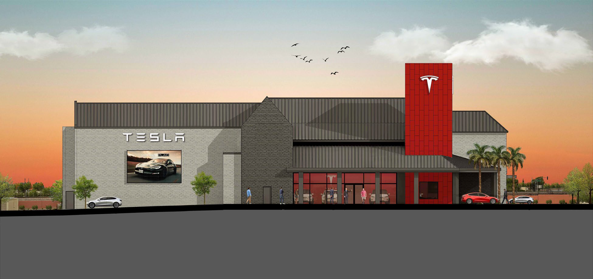
This proposed project would convert the Cinema City movie theater on the corner of La Palma Ave. and Imperial Hwy. to a new Tesla showroom and service center. The staff report for this item can be found online.

When I told my kids about this project, they erupted in protest at the idea of the local movie theater going away. I expect that this will be a very controversial project within the community for that reason, and a number of others. In fact, this property has a long history of controversy going back to the ‘90s when my dad was on Planning Commission.

Before Cinema City was built, this parcel was an undeveloped dirt field next to the Knowlwoods hamburger stand. When the theater was built, many people wanted to grab a burger and then see a movie, which caused parking problems for Knowlwoods since cars were now in their lot for two or three hours instead of cycling through more quickly when they were just getting food. This parking problem came to a head in 1991 when the remainder of the Knowlwoods property was set to be redeveloped as the Promenade Shopping Center that is on the site today. In fact, I went with my dad on a site visit just prior to that shopping center coming before the Planning Commission, and we sat there watching people as they knocked down the chain link fence that had been erected between the two properties with their car so they could easily walk from the restaurant to the theater.

Over the years, a number of solutions to the theater’s parking problem have been attempted. The theater was required to enter into a reciprocal parking agreement with the neighboring bank, as well as construct a parking garage on the back side of the theater. Unfortunately, the parking garage is almost unusable due to sight line issues within the structure and the general tight configuration of the parking and drive aisles. The past few times I’ve been in that center, including just yesterday, the parking garage has been completely closed off. Also, during a hearing for a new CUP for the theater in 2017, it was revealed that the theater had stopped paying on the reciprocal parking agreement and that it therefore was no longer in effect. I expect that these parking issues between the theater property and the neighboring properties will be brought up again at the meeting, more than 30 years after they first became an issue.

In addition to these issues, the nature of a movie theater and a car dealer are quite different. The property owner of the Promenade submitted a letter expressing concern over how the operations of the car dealer might affect his property, especially given that both properties share access from La Palma. One of the findings that the Planning Commission must make to approve any CUP is that the “proposed use will not adversely affect the adjoining land uses.” Given this particular site, I’m not yet sure that’s a determination I can support. I need a bit more information about the existing agreements that are in place, and possibly some modifications to the conditions of approval that would limit some of the dealership operations.

With all of that said, this area in general is not a bad place for a Tesla dealer and service station. Just down the street are dealerships for Mercedes and Land Rover. The question regarding whether the Tesla dealer will fit will hinge on the specifics of this site and whether the impacts to the neighboring businesses can be mitigated.

Item 2 - Citywide Code Update

On a fairly regular basis, the Anaheim planning department updates the City’s zoning code to ensure approval processes are streamlined, that new state laws are incorporated into the City’s code, and to make minor modifications to development standards to respond to changing market trends. This is one of those regular updates. The staff report can be found online, with a summary of amendments here and the complete text amendments here.

Anaheim Planning Commission meeting for February 13, 2023

The Anaheim Planning Commission has a scheduled meeting on February 13, 2023 at 5:00pm in the city council chambers. The agenda for the meeting is available online.

There is only one business item on the agenda, but two other procedural items as well.

Underground Conversion Subcommittee Appointment

The first procedural item is the appointment of a planning commissioner to the city’s Underground Conversion Subcommittee. The subcommittee is made up of five members, three appointed from the Public Utilities Commission and two appointed from the Planning Commission. One of the Planning Commission appointments has opened up due to changes to the commission’s membership. Currently, the subcommittee is made up of Public Utility Board members from districts 1, 2, and 5, and a planning commissioner from district 1.

This is an interesting program that started back in 1990 in an effort to increase electric service reliability and clean up the visual clutter along our city streets. I remember when it started. Back then my dad was on Planning Commission and he had real concerns about the utility under-grounding. Specifically, he was worried that under-grounding the utilities along Santa Ana Canyon Road would ruin the small town character of Anaheim Hills. However, once the project had been completed along that section of road, he realized how much nicer it was to not have all of the power lines hanging above the roadway.

Anaheim Public Utilities provides a great map showing where all of the past, current, and future under-grounding projects are located in the city.

Based on this map, it seems like the majority of the future projects are in districts 3, 4, and 5. Those are the districts that will be the most impacted by these projects, and therefore should have the most representation on the subcommittee. Unfortunately, districts 3 and 4 have no representation currently. We’ll see if my fellow commissioners are interested in changing that.


The second procedural item is election of a vice chair for the commission. I’m throwing my hat in the ring. We’ll see how it goes.

Item 1 - CUP Modification - Travel Inn

The only item on this week’s agenda is a city-initiated modification to an existing Conditional Use Permit (CUP) for the Travel Inn on Beach Boulevard. The staff report can be found online.

This request is very simple. The CUP that was approved last year included a condition that the Travel Inn could not rent rooms to guests younger than 21 years old. This request would modify the condition to reduce the age from 21 to 18.

I do have a few questions about this item:

  1. Is this a standard condition for other hotel and motel establishments in Anaheim?

  2. If it is a standard condition, is the normal age 18 or 21?

  3. If it’s 18, why was the condition for this CUP initially set at 21?

  4. If it’s 21, why is staff recommending lowering it to 18 in this case?

  5. Are there any state laws that regulate the age at which someone must be to rent a hotel or motel room?

Mostly, I want to ensure that we’re treating all businesses in Anaheim consistently with one another, and that we’re not adding unnecessary or duplicative regulations that our businesses must navigate.

I’ll be very interested to hear the answers to these questions on Monday.

Doing Worthwhile Work in City Building

Over the past twenty years of my career, I’ve slowly started to understand what I want to accomplish in my work life. While in college, my goal was broad, to do worthwhile work (thanks, Kevin Salwen) that makes the world a better place. Through circumstance, I ended up in real estate. It has taken me this long to understand the industry well enough to start to see where an individual can focus their efforts to make the greatest positive impact on our built environment. 

Like most industries, the work in city building falls on a spectrum between worthwhile and harmful, with the vast majority of jobs in the thick part of the bell curve that’s mostly neutral. I’m only interested in the jobs in the long tail on the worthwhile side of that spectrum. 

There are four main career paths for city building: policy making, civil service, development, and advocacy. Each of these interact with the others, but no one person can do all of these things simultaneously. 

Policy Making

Anaheim City Hall

Becoming a policy maker is by far the most difficult route to improving city building, but also can be one of the most impactful. At the absolute far end of the spectrum of people who have done the most worthwhile work and made the largest impact are policy makers like California State Senator Scott Wiener. The legislation he has authored and had enacted over the past few years will reshape the urban landscape in California for the next century. But we can’t all be Sen. Wiener. 

Most people who become policy makers with an interest in building better cities are either appointed to their local planning commission or zoning board, or are elected to city council. Policy makers who understand how cities work, and who want to improve the quality of life for residents, are key to making worthwhile changes to our built environment. It will be impossible for anyone working in other areas of city building to make worthwhile improvements without policy maker’s leadership on, or at least acceptance of, better development policies.

However, individuals can’t change policy alone. They need to be able to lead their colleagues to support these worthwhile policies. That leadership, as with all leadership, can be done through charisma or technical excellence, or some combination of the two. However, without a solid understanding of how cities work, it will be hard to know if the policies a policymaker champions are actually worthwhile or not. 

Civil Service

Many people who get a degree in urban planning end up working for a city in their planning department. This certainly isn’t universally true, urban planners also work for consulting firms, architects, and engineers, and some even go on to be developers, but many work in the civil service. 

While I’ve never worked for a city, I’ve worked with many cities and their staff in a variety of roles. I’ve seen how city staff can help make their cities better, make their cities worse, but more often than not, how they don’t affect their city in the slightest. 

The best staff I’ve worked with focus on how new developments impact actual people, and not just whether they comply with the zoning code or not. These staff also tend to be more receptive to new ideas and make opportunities for developers and advocates to make the case for these new ideas to the policy makers. 

As an individual, if you want to work in local government to make your city a better place, work in the planning department with a focus on how new developments in the city make residents happier and more prosperous. Make room for new ideas, and as you move up, you’ll be able to lead a complete reorientation of your city’s urban planning to focus on those key metrics of happiness and prosperity.

Development

The Irvine Community Land Trust’s Sage Park development, an affordable condo community in Irvine, CA

Of these paths, developers are the only ones that directly change the built environment. (Traffic engineers and public works departments also directly change the built environment, but as an individual, that seems like a hopeless avenue to go down to make worthwhile change.) Many people who grew up playing SimCity or Cities: Skylines who go on to become urban planners really want to be developers, because they get to make tangible changes to their communities.

It’s easy to be a bad developer, and it’s hard to be a good one. All of the incentives are to make bad projects. John Anderson talks about how the common perception of developers is that they’re Darth Vader, but to be welcomed into a community developers don’t need to be Ghandi, but just need to demonstrate that they are significantly better than Darth Vader.

However, even good developers can’t make positive changes to our built environment without the support of civil servants to bring forward their proposals and policy makers to approve their designs. While many people view developers as having too much power over the decision-making process, my experience is the exact opposite. Developers are often very constrained in what they’re allowed to build, and as often as not the developments they want to pursue don’t move forward because of opposition from city staff, city leaders, or community concerns.

Advocacy

For people who haven’t made a career in city building but still want to positively impact the built environment, one of the most powerful roles anyone can play is that of an advocate. I’ve seen many good projects that serve an urgent community need get killed because of community opposition. Cities need advocates for good projects to counter those members of the community that oppose any change.

The easiest way to become an advocate is to just show up to planning commission and city council meeting and share your thoughts about what’s happening in your community. But one lone voice in the wilderness is often not enough to sway decisionmakers. To do that, you must find others who share your views and can amplify your shared message. 

However, even with a group of community members advocating for a better city, it is often too easy for policy makers to ignore. For advocates to be successful, they need receptive civil servants that will incorporate their aims into staff recommendations, they need policy makers that will listen to them and use their comments as justification to support developments even in face of opposition from other members of the community, and they need developers that are proposing quality projects they can get behind to support. 


But what about all of the other folks who work in city building, such as the architects, civil engineers, and planning consultants such as myself? The short answer is that we’re all just agents of the folks paying us. We may be able to pick our clients or the projects we work on to ensure those projects are worthwhile, but if we’re hired by a city, our powers to do good are the same as those in the civil service, if we’re hired by a developer, our powers to do good are the same as the developers (and let’s be honest, most of the time the advocates and policy makers aren’t hiring us.) 

There is a lot of good and urgent work city builders need to be working on right now. Our urban form helps determine our health and happiness, it drives our homelessness epidemic and climate change. Solving these problems will take changing our built environment, and that won’t happen unless folks pursue worthwhile work in city building.

Grant Henninger
Anaheim Planning Commission meeting for Januarly 18, 2023

The Anaheim Planning Commission has a scheduled meeting on January 18, 2023 at 5:00pm in the city council chambers. The agenda for the meeting is available online.

There are two items on the agenda, an application for a liquor license and an application for a new condo community.

Item 1 - Liquor License - 1020 North Euclid Avenue

Item 1 on this week’s agenda is an application for an Alcohol Beverage Control (ABC) license for a new grocery store at the corner of Euclid and La Palma. The staff report can be found online.

This new store is currently being built out in an existing retail building that had previously been a Ralphs grocery store. The ABC license would only allow for sales of alcohol for off-site consumption, and not allow people to drink the alcohol at the store.

Requests for ABC licenses only come before the planning commission if its for business located in a census tract that has a high concentration of existing licenses or if it’s in a police reporting area that has a higher crime rate than average for the city. This is dictated by state law, and is not something that the city has a lot of control over other than to approve or deny the application.

With that said, public hearings for liquor licenses are largely pointless and the law should be changed so they’re not required. I’ve never seen one of these applications be rejected. On top of that, the standards for what triggers a public hearing don’t make much sense.

The crime stats are based on the average for the city, but do not take into account whether the city has high or low crime overall. Also, there is no tie between the type of crime and alcohol. For this application, there were 164 crimes including 68 thefts, 25 vandalisms, and 51 drug violations, which don’t seem to be the types of crimes that are exacerbated by alcohol.

Additionally, the number of permitted licenses without a hearing in each census tract doesn’t take into account the type of development in each tract. Census tracts are small, and ones like this one incorporate part of a major commercial area, whereas others are primarily residential. Strangely, the residential tracts can have more licenses because they have more residents. That just seems backwards.

Coming back to this specific project, the application was on the December 5, 2022 agenda. For some reason it was continued to this meeting for more study. I’m interested in understanding what needed additional study for this application.

Item 2 - Condo Development Application - 2219 West Orange Avenue

Item 2 on this week’s agenda is a collection of actions for the development of a new 24-unit condo community located on Orange Street just west of Brookhurst. Ten percent of the units will be affordable to moderate income buyers. The staff report can be found online.

This application includes a General Plan Amendment, Zone Change, Conditional Use Permit (CUP), Tentative Tract Map (TTM), and certification of a Mitigated Negative Declaration (MND).

The site currently is home to Faith Lutheran Church. The church is going to subdivide their property, keeping the main church building while demolishing the existing preschool and daycare buildings.

Due to the space limitations of the site, the developer is proposing reducing some of the setbacks and building separation below what is required by code. They are achieving this partly through a density bonus agreement they get as part of the affordability restrictions, and partly through processing the CUP, which allows for consideration of the smaller setbacks. As stated in the staff report, “this is consistent with modifications granted previously to similar projects.”

In fact, everything about this project appears to be consistent with other approved projects. Every time a project comes before the Planning Commission or City Council and is approved, it’s a policy failure. Our General Plan and zoning code should clearly identify what we want built in our city, and make it easy for developments that meet those standards to be approved.

Applications for this project were originally submitted in 2021, and it has taken more than a year to get to a hearing for approval. While not every part of this application could be approved at the staff level, Anaheim could reduce the number of asks projects like this are making.

The only part of this project that is required to come before the commission and council for consideration is the Tentative Tract Map. All of the other requests should be consistent with the City’s code. So how can the City modify its code to ensure projects that are routinely approved can move forward without a public hearing?

The existing General Plan land use designation for this site is Corridor Residential, which allows for “single-family attached housing fronting on arterial highways and incorporating a rear access drive or service alley” at a density of up to 13 units per acre. The General Plan should allow for much higher densities and many more building types along the city’s arterial corridors. The Corridor Residential land use should be consistent with the requirements of the newly enacted AB 2011. If this proposal was consistent with the land use designation of the site, then the project would be eligible for a Class 32 exemption from the California Environmental Quality Act (CEQA) for urban infill projects, which would mean the MND would not have been required.

The zoning designation for this site is Transitional, which is often used between two zones where the city doesn’t really know which way the parcel will go. In this case, the site is between the commercial uses on Brookhurst and the residential uses on Orange. The city should eliminate the use of the Transitional zone, and should rezone these properties to be consistent with the General Plan. The use of the Transitional zone requires that a zone change be considered before anything is developed on these sites.

An example of parallel sidewalks. Even my son said, “That sidewalk configuration is stupid, why don’t they just make one bigger sidewalk.”

City standards require that a private sidewalk is provided on the interior of the site, even when that sidewalk runs parallel to the public sidewalk. This is a complete waste of land and resources. This project includes two sidewalks along the frontage with Orange Ave., separated by a short wall. This makes the experience of walking along the public sidewalk worse because it makes for a more boring walk than if the homes were closer to the street. With this project being so close to Brookhurst Ave., which has significant amounts of retail and transit, this should be a site where we’re maximizing the walkability for not only the residents that will live here, but those that live nearby.

Detail of proposed street frontage with double sidewalks.

Additionally, the space for the sidewalk and wall force the buildings further back into the property. In this case, there is an additional eight feet of setback along the street frontage. Without this, the buildings could be shifted eight feet towards the street, removing the need for any modification to the setback requirements along the northern property line adjacent to existing single-family homes.

The developer for this project did some outreach to the neighboring community beyond what was required by statute. I’ll be interested to hear if anybody has any public comments about this project.